| Home | AmMin | GMR | RiMG | Collectors Corner | Directory | Short Courses | |
|
|
|||||||

|
VIRTUAL
FIELD TRIP TO THE KEWEENAW PENINSULA, MICHIGAN - STRUCTURE
|
The Keweenaw peninsula is bisected by the Keweenaw fault, which is the boundary between the mid continent rift and other Precambrian terrains. Lake Superior is the result of a combination of a geological syncline which helped form a structural basin that has been subsequently enhanced by the actions of glaciers which excavated the softer rocks which previously occupied the middle of the syncline.
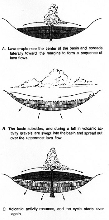
The midcontinent rift (Precambrian in age) starts in northern Kansas and runs under Lake Superior and then turns south to run through lower Michigan. It was similar to the East Africa rift as parts of the continent tried to separate, but were ultimately unsuccessful in the attempt to break into separate land masses. As the rift developed, there were two bounding graben faults at either side of the rift, the Keweenaw fault on the eastern side of the rift and the Isle Royale fault on the western edge of the rift. As the rocks were being down-warped, igneous extrusions filled the rift valley. These eruptions were almost exclusively on dry land ( there is one location on the Keweenaw peninsula and several small areas on Isle Royale that were erupted under water - as seen in the development of pillow lavas). During periods of volcanic quiescence, the down-warping continued and sedimentary rocks were formed from the erosion of the surrounding higher land areas.
The Keweenaw is the eastern flank of a large syncline under Lake Superior, while the rock outcrops on Isle Royale represent the western flank of the syncline. Most of the rocks generally dip about 20 degrees to the west on the Keweenaw peninsula. There are minor gentle folds, synclines and anticlines that have amplitudes extending over 10 km distances in the Keweenaw that along with cross faults, tend to provide pathways for the copper ore solutions and localize the deposition of native copper. The Allouez gap fault provided the most productive pathway through the volcanics. More rock formations were mineralized next to this fault than any other structure in the Keweenaw.
About 30 million years after the rift formed, the region was placed under compression by the northwest movement of the plate along the Grenville front ( this is located several hundred miles to the southeast). This compression resulted in the normal graben faults becoming reverse faults. Although the Keweenaw fault is present throughout the length of the peninsula, it is poorly exposed along it's entire length. |
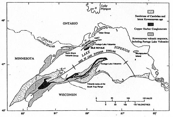
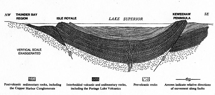
A cross section of the Lake Superior basin from Thunder Bay Canada, through Isle
Royale and to the Keweenaw peninsula. From USGS Bulletin 1309, figure 38.