Butler & Burbank USGS PP 144
ILLUSTRATIONS
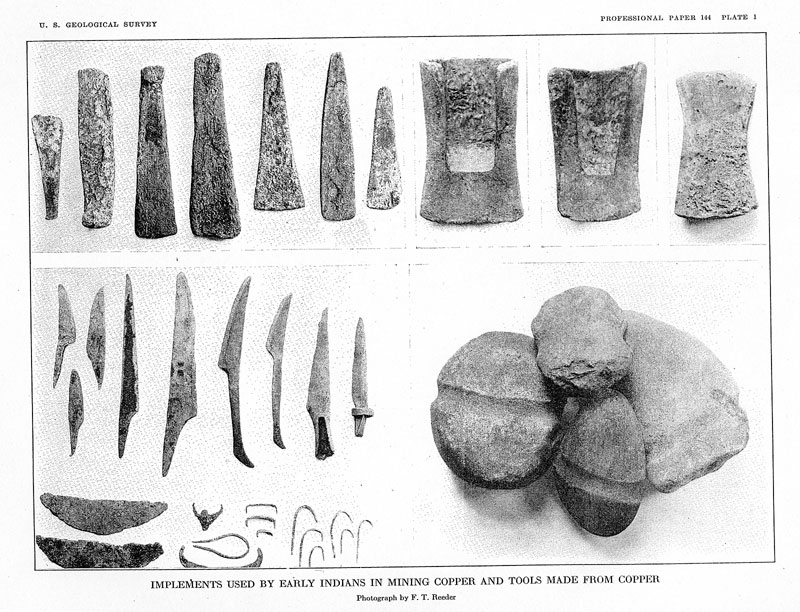
PLATE 1. Implements used by early Indians in mining copper and tools made from
copper---------------------------1
2. General geologic map and sections of the Keweenawan and associated rocks in the Lake Superior copper
district------------------------------------------------------------------------------------- In pocket.
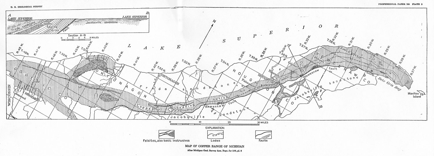
3. Map of Copper Range of Michigan--------------------------------------------------------------- In pocket.
4. Topographic map of central portion of Copper Range from
Painesdale to Cliff, Mich-------------------- In pocket.
5. Geologic map of Copper Range, Mich., from Keweenaw Point to Mount Houghton--------------------- In pocket.
6. Geologic map of Copper Range from Mount Houghton to Delaware----------------------------------- In pocket.
7. Geologic map of Copper Range from Copper Falls to Gratiot----------------------------------------- In pocket.
8. Geologic map of Copper Range from Gratiot to LaSalle--------------------------------------------- In pocket.
9. Geologic map of Copper Range from LaSalle to Atlantic--------------------------------------------- In pocket.
10. Geologic map of Copper Range from Atlantic to Challenge------------------------------------------- In pocket.
11. Geologic map of Copper Range from Challenge to Winona------------------------------------------- In pocket.
12. Geologic map of Copper Range from Winona to Adventure------------------------------------------ In pocket.
13. Geologic map of Copper Range from Adventure to Victoria------------------------------------------ In pocket.
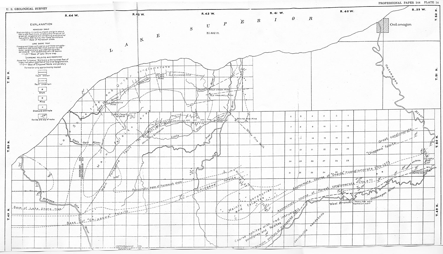
14. General geologic map from Presque Isle River to Victoria mine,
Mich--------------------------------- In pocket.
15. Stratigraphic sections of Copper Range, Mich
------------------------------------------------------ In pocket.
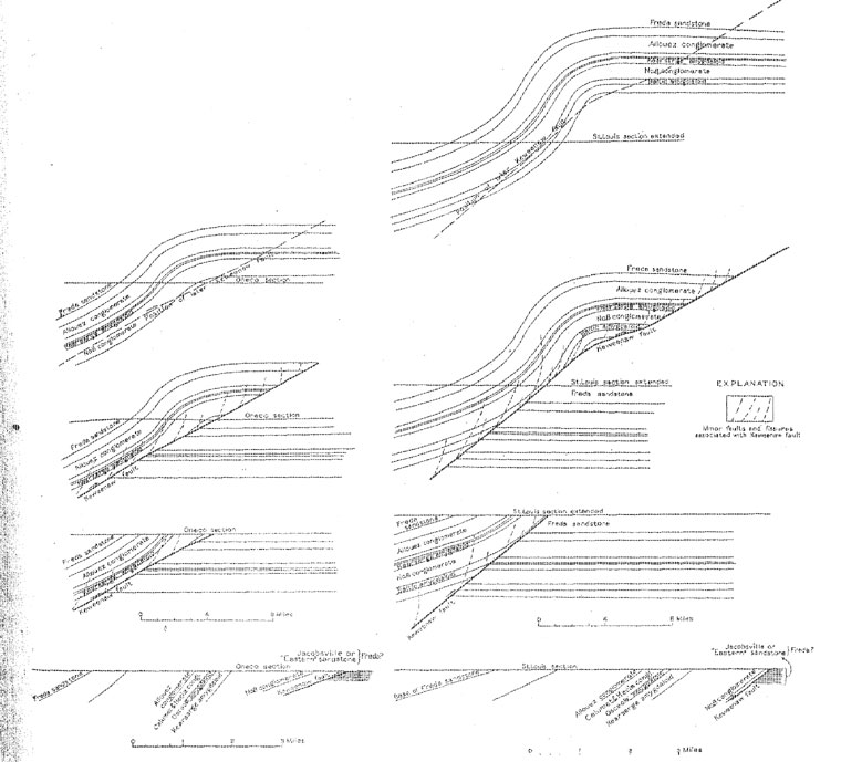
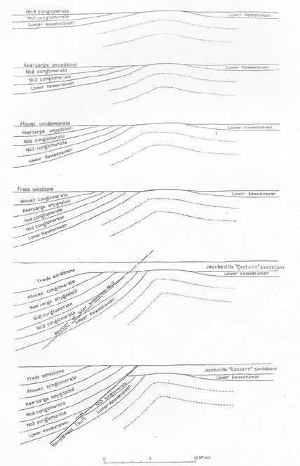
16. Geologic sections in T. 58 N., Rs. 28 and 29 W----------------------------------------------------- In pocket.
17. Manitou and North Cliff geologic sections--------------------------------------------------------- In pocket.
18. Geologic sections in Tps. 57 and 58 N., Rs. 31 and 32 W-------------------------------------------- In pocket.
19. Geologic sections in Tps. 56 and 57 N., R. 32 W---------------------------------------------------- In pocket.
20. Geologic sections in T. 56 N., Rs. 32 and 33 W----------------------------------------------------- In pocket.
21. Geologic sections in T.56 N., R.33 W------------------------------------------------------------ In pocket.
22. Geologic sections in Tps. 55 and 56 N., R. 33 W---------------------------------------------------- In pocket.
23. Geologic sections in Quincy mine, T. 55 N., R. 34 W------------------------------------------------ In pocket.
24. Geologic sections in Tps. 54 and 55 N., R. 34 W---------------------------------------------------- In pocket.
25. Geologic sections in T. 53 N., R. 35 W., and T. 54 N., R. 34 W-------------------------------------- In pocket.
26. Geologic sections of Copper Range diamond-drill holes, T. 53 N., R. 35 W----------------------------- In pocket.
27. Geologic sections in T. 52 N., R. 36 W., and T. 53 N., R. 35 W-------------------------------------- In pocket.
28. Geologic sections in Elm River & Contact Copper Co.'s mines, T. 52 N., R. 36 W---------------------- In pocket.
29. Geologic sections in T. 52 N., R. 36 W., and T. 51 N., R. 37 W-------------------------------------- In pocket.
30. Geologic sections in T. 51 N., R. 37 W., and Tps. 50 and 51 N., R. 38 W------------------------------ In pocket.
31. Geologic sections in T. 50 N., Rs. 38 and 39 W., and T. 51 N., R. 38 W------------------------------- In pocket.
32. Geologic sections in T. 49 N., Rs. 40, 41, and 42 W------------------------------------------------- In pocket.
33. Maps of White Pine mine------------------------------------------------------------------------ In pocket.
34. Longitudinal sections of Ashbed lode-------------------------------------------------------------- In pocket.
35. Longitudinal sections of Hancock
lode------------------------------------------------------------- In pocket.
36. Longitudinal sections of Pewabic lode------------------------------------------------------------- In pocket.
37. Longitudinal sections of Allouez conglomerate and Keweenaw mine----------------------------------- In pocket.
38. Longitudinal sections of Calumet & Hecla conglomerate--------------------------------------------- In pocket.
39. Longitudinal sections of Osceola lode-------------------------------------------------------------- In pocket.
40. Longitudinal section of Kearsarge lode------------------------------------------------------------- In pocket.
41. Longitudinal sections of Isle Royale lode---------------------------------------------------------- In pocket.
42. Longitudinal sections of Old Arcadian and Winona lodes--------------------------------------------- In pocket.
43. Longitudinal sections of Knowlton
lode------------------------------------------------------------ In pocket.
44. Longitudinal sections of Ogima lode--------------------------------------------------------------- In pocket.
45. Longitudinal sections of Butler and Ogima lodes---------------------------------------------------- In pocket.
46. Longitudinal sections of Evergreen lode----------------------------------------------------------- In pocket.
47. Longitudinal section of Forest lode, Evergreen mine------------------------------------------------- In pocket.
48. Longitudinal sections of Superior and Lake lodes--------------------------------------------------- In pocket.
49. Longitudinal sections of Baltic and Baltic West lodes----------------------------------------------- In pocket.
50. Sections showing development along fissures from Ahmeek mine to Pennsylvania mine------------------- In pocket.
51. Sections showing development along Mass fissure, Ahmeek mine------------------------------------ .-- In pocket.
52. Development of Minesota fissure and associated lodes of Michigan mine------------------------------- In pocket.
53. Ridges produced by resistant flows-------------------------------------------------------------------- 16
54. A, Douglass Houghton Falls; B, Drill cores improperly stored; C, Glaciated surface showing resistance of
amygdular inclusions-----------------------------------------------------------------------------17
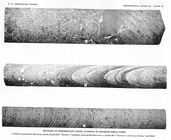
55. Texture of sedimentary rocks as shown in diamond-drill
cores--------------------------------------------36
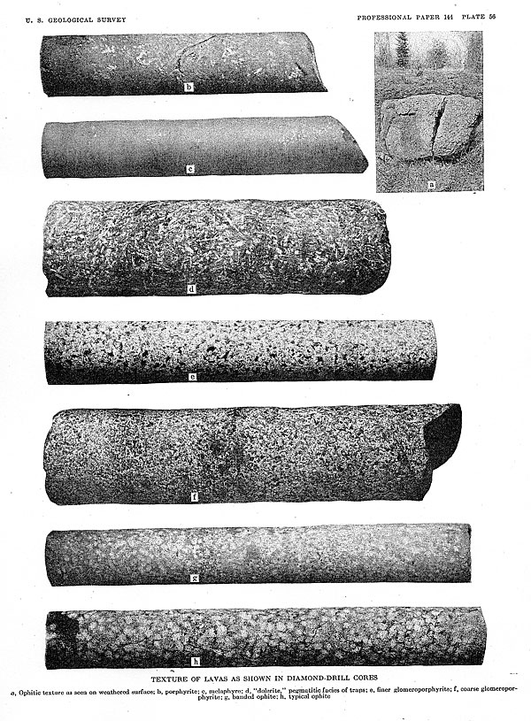
56. Texture of lavas as shown in diamond-drill cores--------------------------------------------------------36
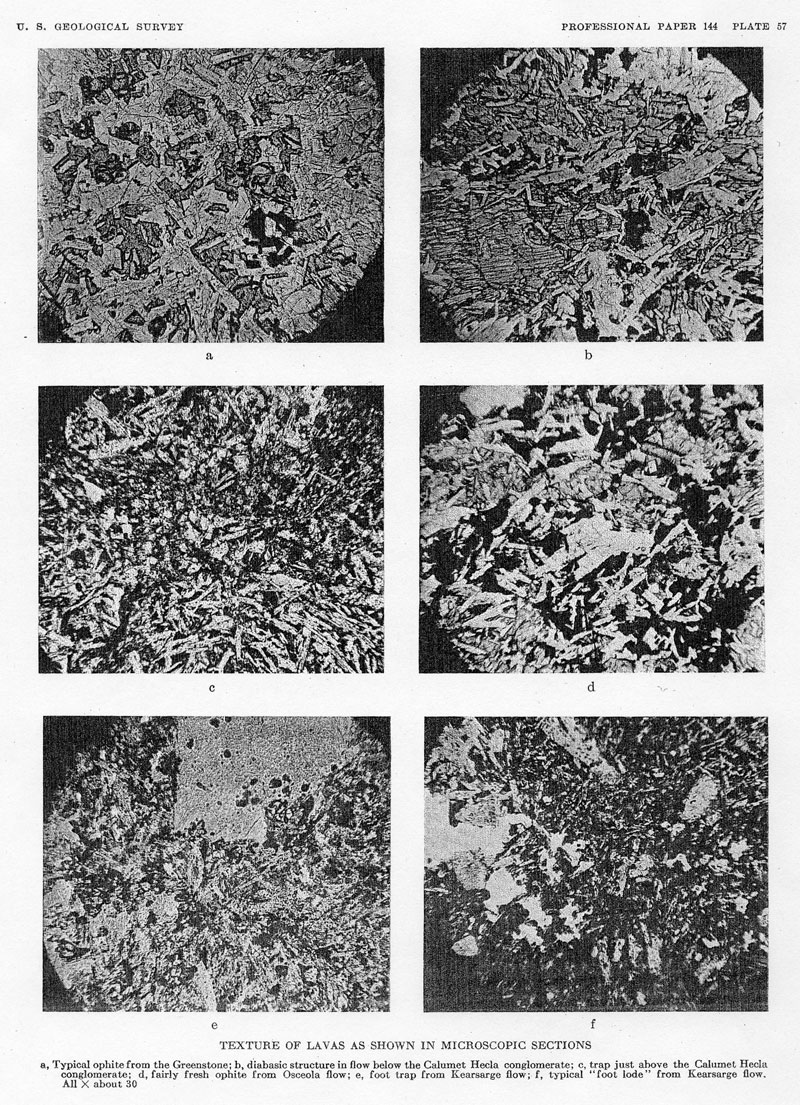
57. Texture of lavas as shown in microscopic sections------------------------------------------------------36
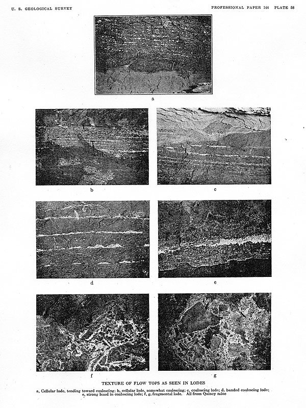
58. Texture of flow tops as seen in lodes------------------------------------------------------------------36
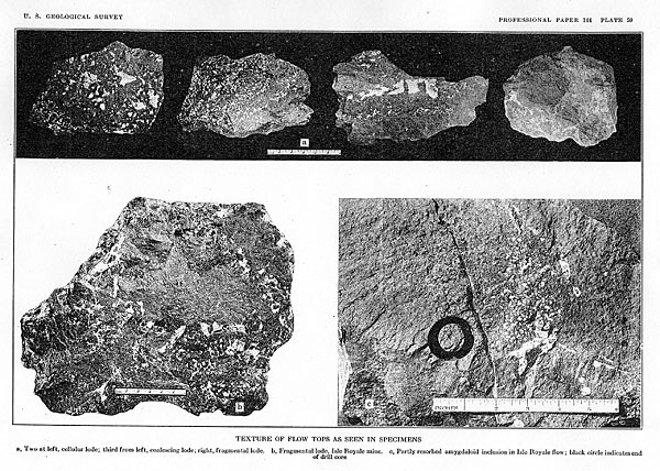
59. Texture of flow tops as seen in specimens--------------------------------------------------------------36
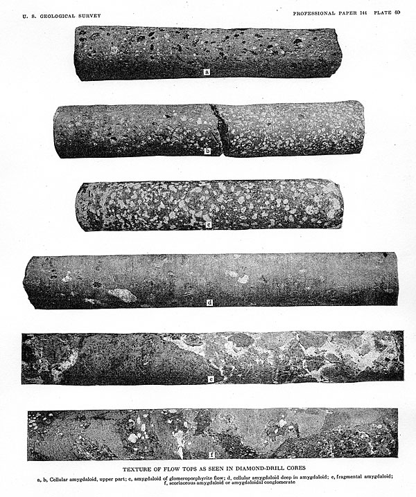
60. Texture of flow tops as seen in diamond-drill cores------------------------------------------------------36
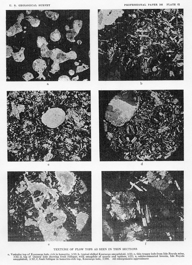
61. Texture of flow tops as seen in thin sections------------------------------------------------------------36
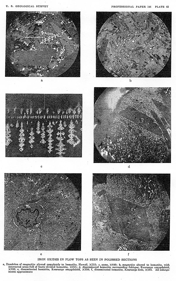
62. Iron oxides in flow tops as seen in polished
sections-----------------------------------------------------36
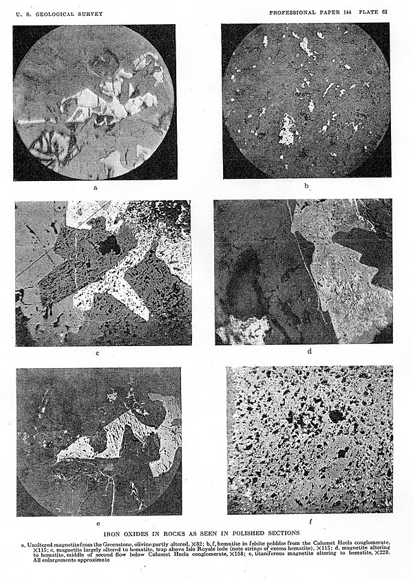
63. Iron oxides in rocks as seen in polished sections---------------------------------------------------------36
64. Alteration and replacement of minerals----------------------------------------------------------------37
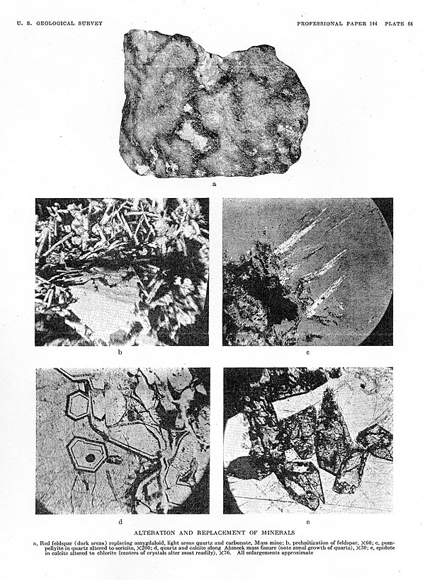
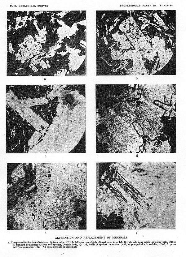
65. Alteration and replacement of minerals---------------------------------------------------------------52
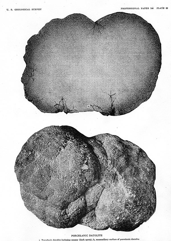
66. A, Porcelanic datolite inclosing copper; B, Mammillary surface of porcelanic
datolite------------------------52
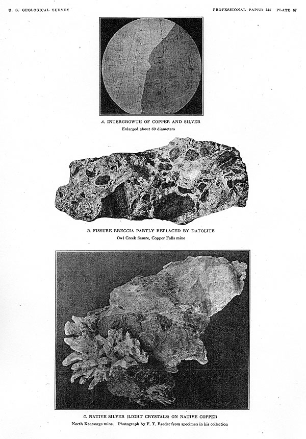
67. A, Intergrowth of copper and silver; B, Fissure breccia partly replaced by
datolite; C, Native silver on native
copper------------------------------------------------------------------------------------------52
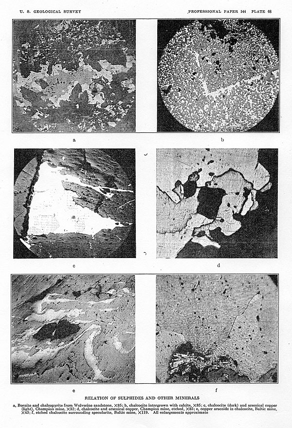
68. Relation of sulphides and other minerals---------------------------------------------------------------53
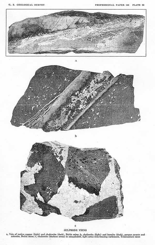
69. Sulphide veins--------------------------------------------------------------------------------------132
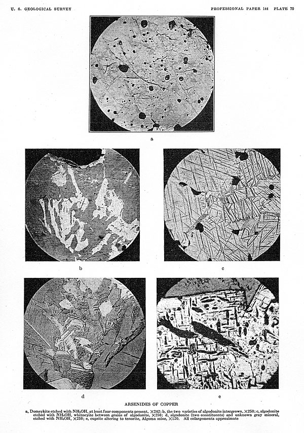
70. Arsenides of copper---------------------------------------------------------------------------------132
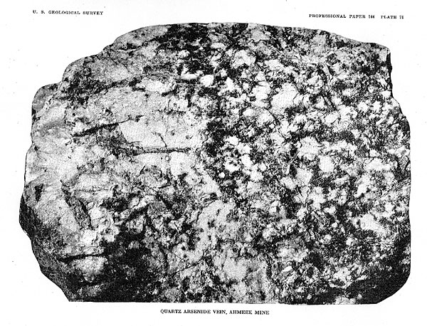
71. Quartz arsenide vein, Ahmeek mine-------------------------------------------------------------------132
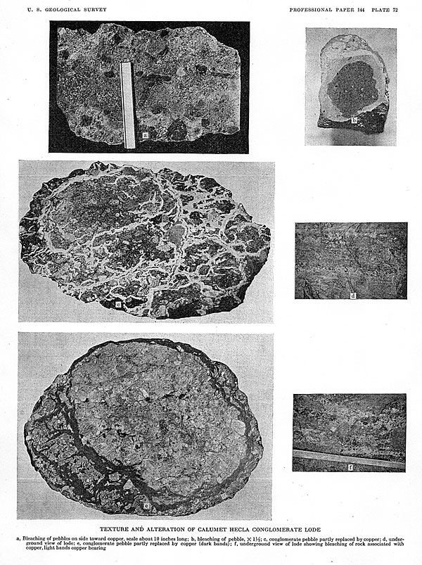
72. Texture and alteration of Calumet & Hecia conglomerate
lode--------------------------------------------132
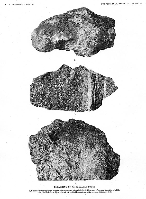
73. Bleaching of amygdaloid- lodes associated with copper and
sulphide----------------------------------------132
74. A, No. 2 shaft house, Quincy mine; B, Shaft houses, Baltic mine; C, View looking north from Isle Royale mine to
Quincy Hill over Portage Lake--------------------------------------------------------------------- 133
75. A, Shafts on Kearsarge lode;B, Shafts on Winona lode; C, North Bluff and shafts and dumps of Calico and Minesota
lodes, Michigan mine; D, Calumet, showing shafts on Calumet & Hecla conglomerate and Osceola
amygdaloid- 180
FIGURE 1.
Variation in thickness of Kearsarge flow--------------------------------------------------------------- 22
2. Change in iron in lava top at Twin Falls, Idaho------------------------------------------------------- 35
3. Iron content of smooth-top flow--------------------------------------------------------------------- 36
4. Iron content of Kearsarge flow---------------------------------------------------------------------- 36
5. Gains and losses in constituents in oxidized tops, as compared with trap portions of flows------------------- 40
6. Change in character and content of iron in different parts of lava flows----------------------------------- 41
7. Stability relation for the equation Fe3O4+
CO<-->3FeO+CO2--------------------------------------------- 44
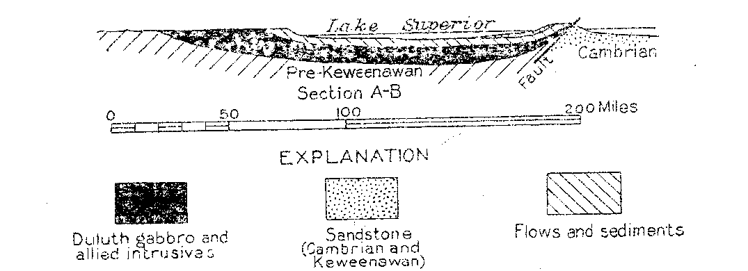
8. Geologic section from Vermilion Lake, Ontario, to Calumet,
Mich--------------------------------------- 46
9. Possible development of the Keweenaw fault--------------------------------------------------------- 51
10. Possible development of the Keweenaw fault--------------------------------------------------------- 51
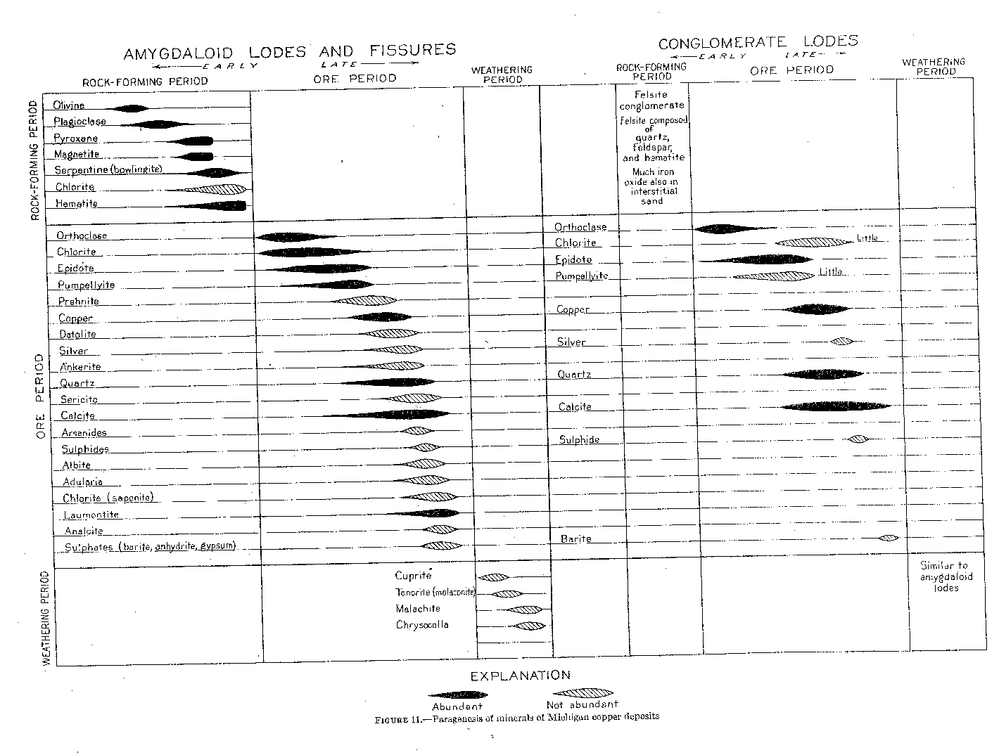
11. Paragenesis of minerals of Michigan copper deposits------------------------------------------------- 54
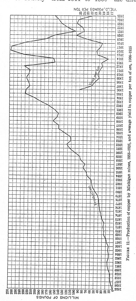
12. Production of copper by Michigan mines, 1855-1925, and yield per ton,
1906-1925-------------------------64
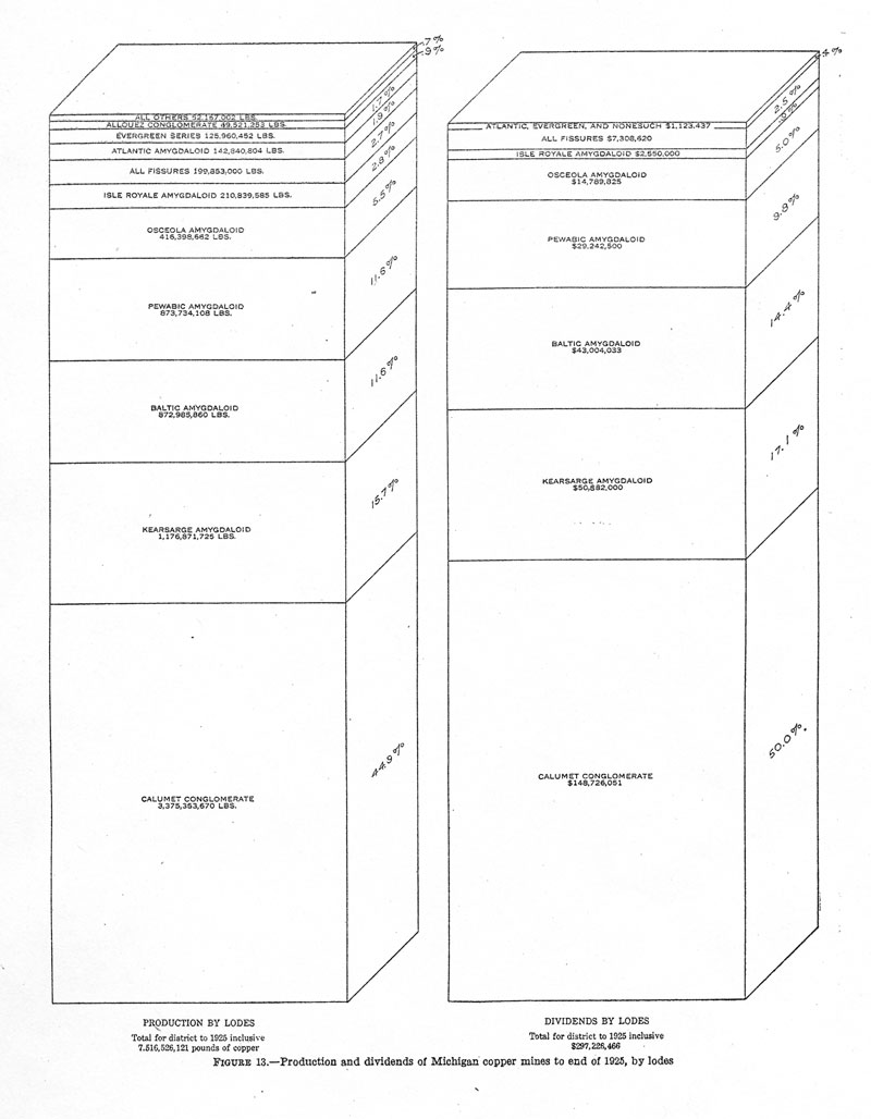
13. Production and dividends of Michigan copper mines, to end of 1925, by
lodes.----------------------------65
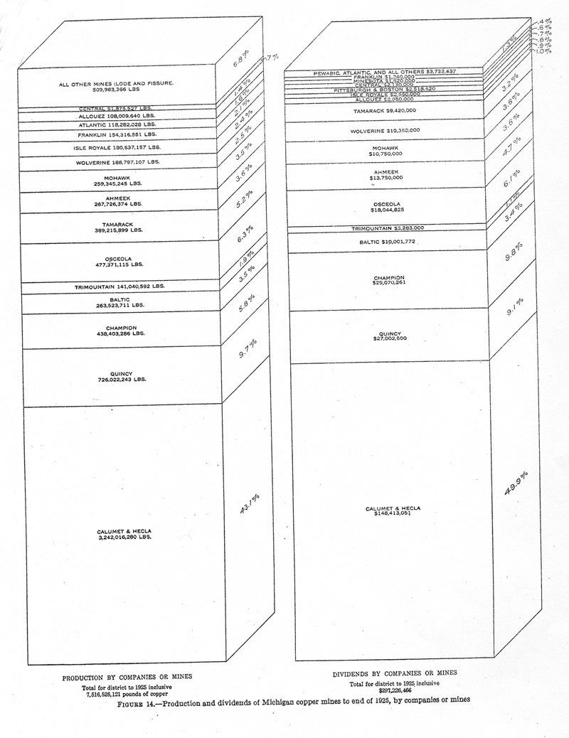
14. Production and dividends of Michigan copper mines, to end of 1925, by companies or
mines---------------- 66
15. Variation in copper content per foot of depth, Calumet & Hecla mine------------------------------------ 104
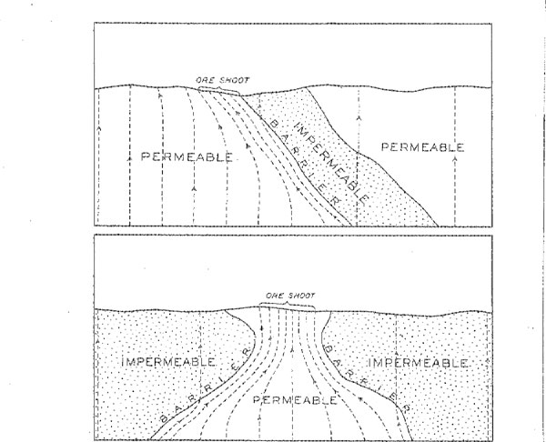
16. Influence of varying permeability of rock on flow of solutions and formation of ore
shoots------------------- 116
17. Change in iron content in bleached rock associated with copper------------------------------------------ 133
18. Composition of bleached and unbleached rock-------------------------------------------------------- 134